

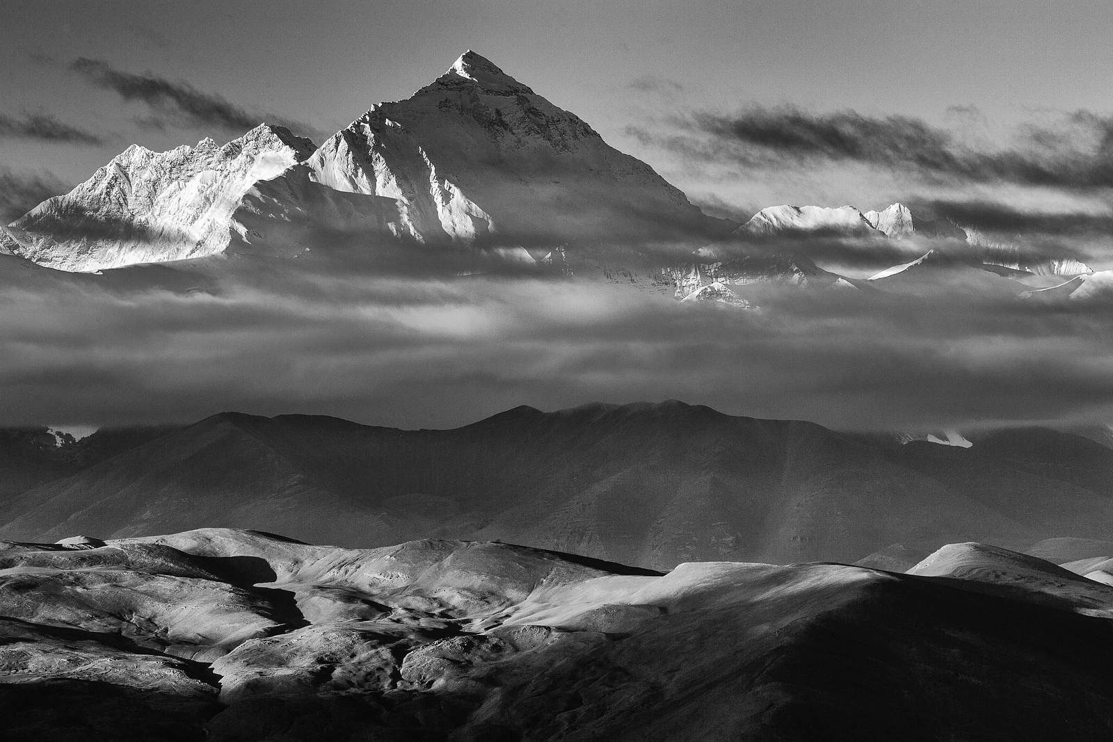
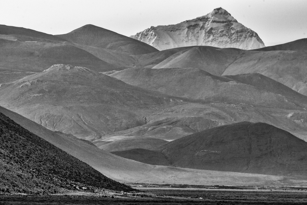
Mount Everest North Face.
My first view of the Rocky Mountains in Alberta, Canada more than 40 years ago created in me a feeling of awe and amazement at such beauty and power. The attraction of those mountains has drawn me back countless times since. Even after those many visits, my love for the mountains continues to strengthen, being much deeper today than in my youth, now affecting me much more on a spiritual level than in a material or physical manner. I have been so fortunate to experience mountains across the globe; in my Canadian backyard, in the United States, at the summit of Kilimanjaro in Africa, and in the Himalayas in Tibet, Bhutan, and Nepal. This photo story shares my first experience in the magical Himalayas; a trek that I did in 2005 from the village of Tingri to the East Rongbuk Glacier on the north face of Mount Everest.
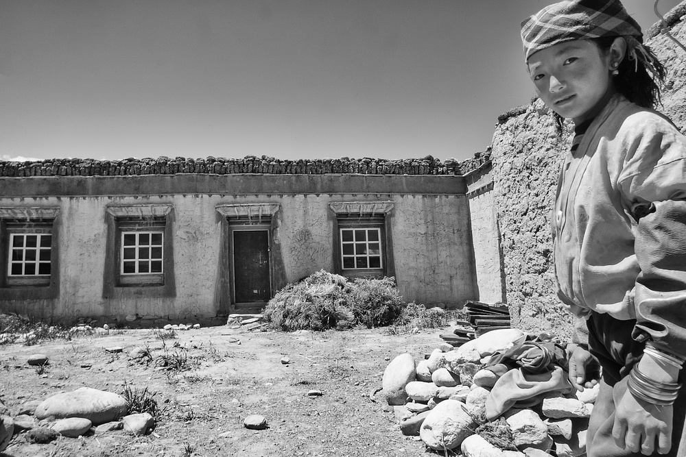
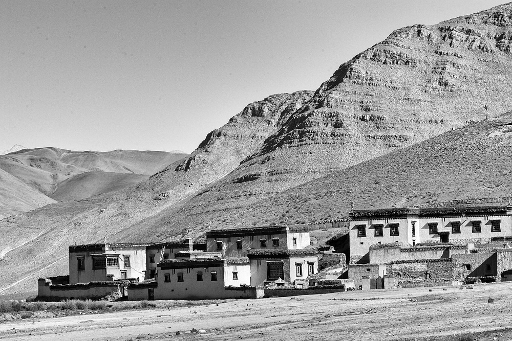 Houses in Tingri.
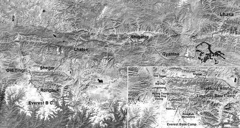
Tingri is located approximately 560 kilometers west of Lhasa, the capital city of the Tibet Autonomous Region in China. Often referred to as the Gateway to Everest, Tingri is the point where vehicles turn south from the Sino-Nepal Friendship Highway (that connects Lhasa and Kathmandu) to drive the approximate 100 kilometers to Everest’s north Base Camp. This S207 road was built by the Chinese in 1959 to support their attempt to summit Mount Everest in 1960 and it has since been the primary route for visitors to Base Camp.
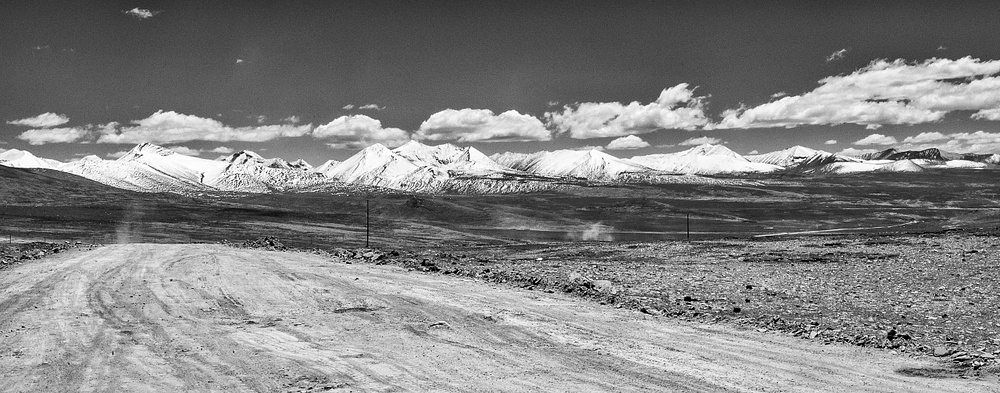 Approaching the Himalayas on the Friendship "Highway".
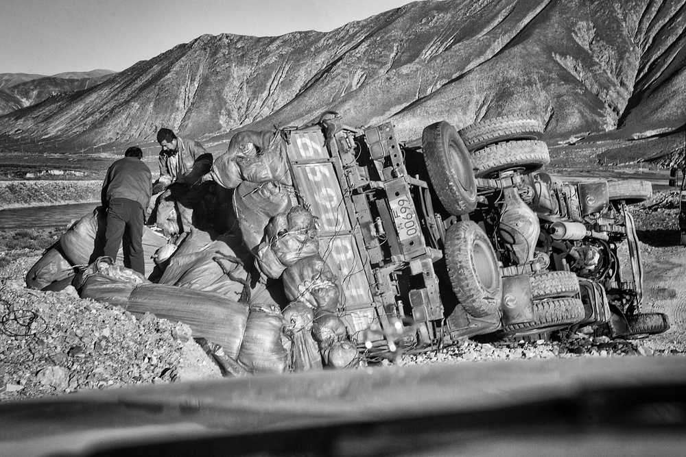
 My travel to Tingri was an adventure in itself, starting the 270-kilometer drive from the city of Shigatse and taking 11 hours on mostly very rough dirt roads, with numerous detours due to construction and landslides. The drive had the usual hazards of donkeys, yaks, sheep, and cattle, as well as overturned vehicles.
 Map of my trekking route.
It is from Tingri that I started my trek. Avoiding the S207 road, the route driven by almost all current visitors to Base Camp, allowed me to be the only trekker on a spectacular journey across the Tingri Plains, over Lamna La pass, to the Rongbuk Monastery, Everest Base Camp and on to the East Rongbuk Glacier.
The East Rongbuk Glacier is famed in mountaineering history for being the route first discovered by George Mallory’s team in 1921 as a viable route to the summit of the world’s highest mountain. It is now the pathway to the Advanced Base Camp for those attempting to summit via the North Col and northeast ridge of Everest.
The goal of my trek was to visit the spectacular ice seracs at an elevation of 20,000 feet (the traditional Camp 2) on this Glacier, about 2 km and 1300 feet below Advanced Base Camp.
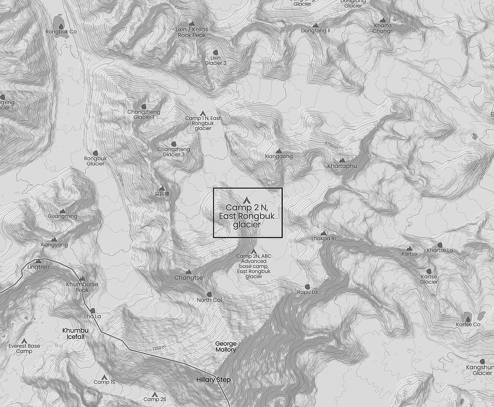
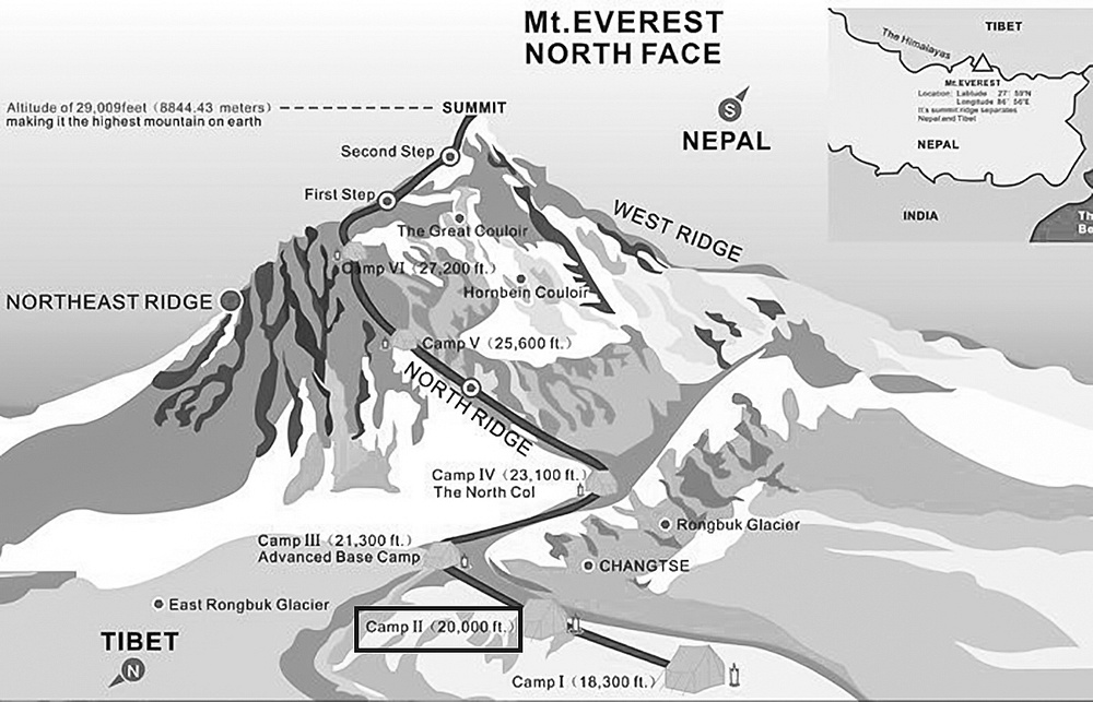 Maps that show the route and location of camp 2.
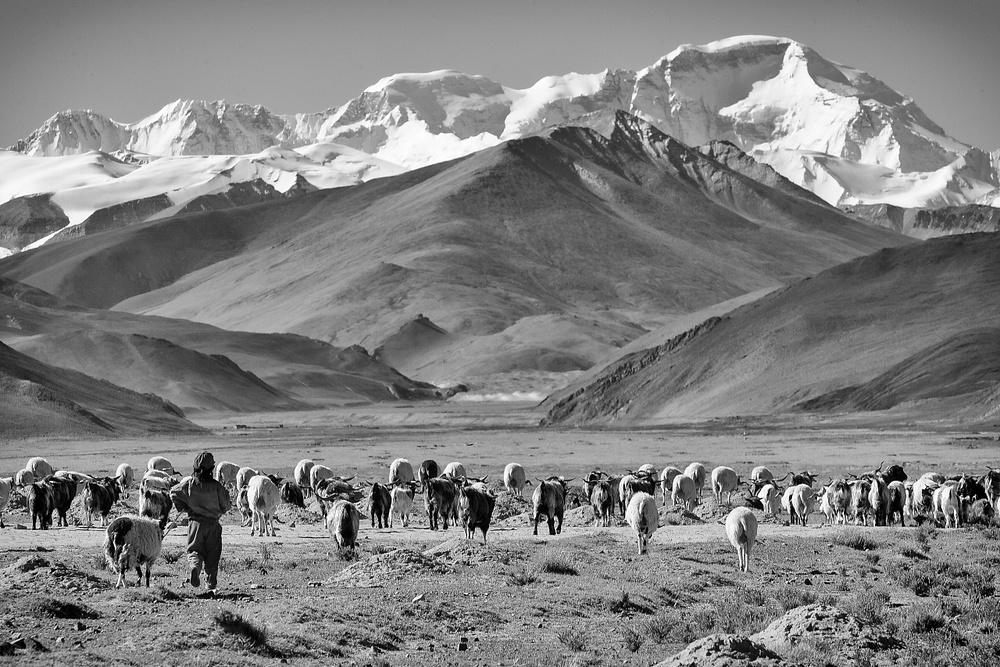 Young shepherd on Tingri plain with Cho Oyu in the background.
My first campsite was in the open fields near Tingri (14,400 feet elevation) and was the starting point for an easy hike through the Ra-Chu Valley to the small village of Lungthang. On my way, while watching the local Tibetans harvesting their barley and herding their sheep, I was mesmerized by my first close-up view of the Himalayas, as they provided an unbelievable backdrop to the Tingri Plains, and gifted me with an unobstructed view of Cho Oyu, the world’s 6th highest mountain, and Gyachung Kang, the 15th highest in the world and the highest peak lying in my view between Cho Oyu and Mount Everest. On this initial day of my trek, I was also teased with my first view of Mount Everest, but only by its summit as it peeked above the 100 kilometers of rolling foothills that lie between us.
 Cho Oyu, world's 6th highest mountain.
 My first view of Everest.
 Sonam and her house in Lungthang.
While walking through the village of Lungthang I had the very good fortune to meet a 12-year-old girl named Sonam who was excited to talk with me (through my interpreter and guide, Tsering Phackmo). She introduced me to one of the village elders as well as invited me into her home to share yak butter tea with her and her grandmother, Lhakpa, with whom she lived. This brief time in conversation with Sonam and Lhakpa would be one of my most special of this whole trek as they were happy to share with me some of what it is like to live in this very remote, challenging and beautiful land.
 Sonam and a village elder.
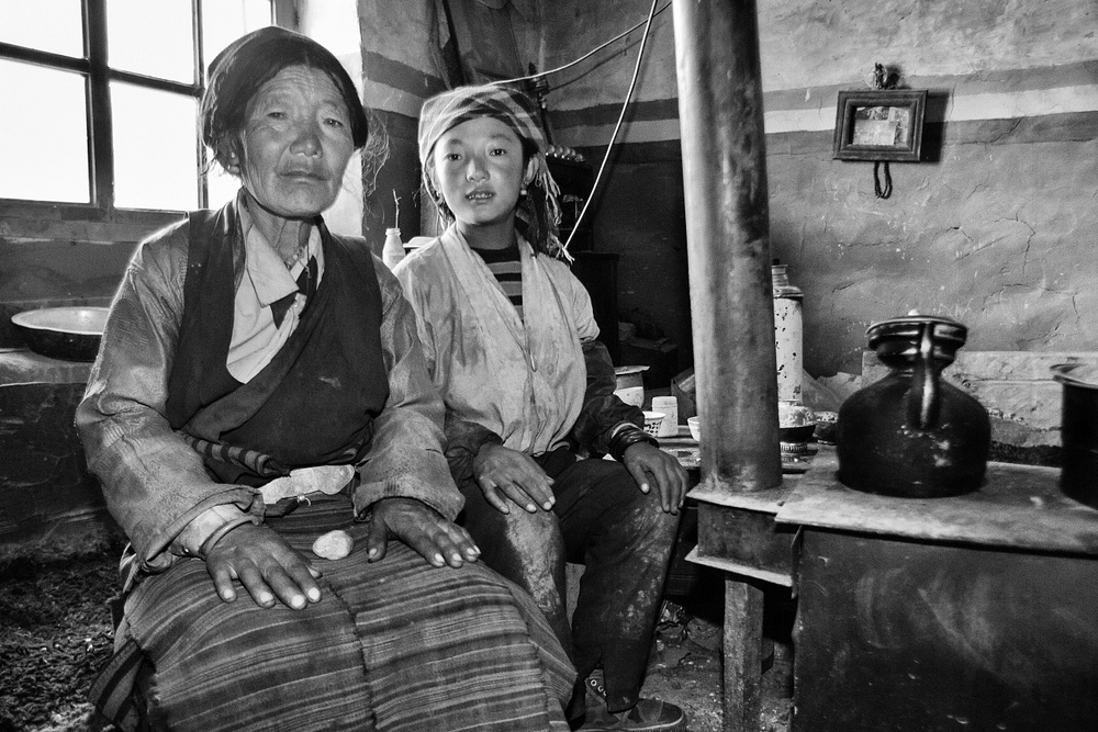 Sonam and Lhakpa in their kitchen.
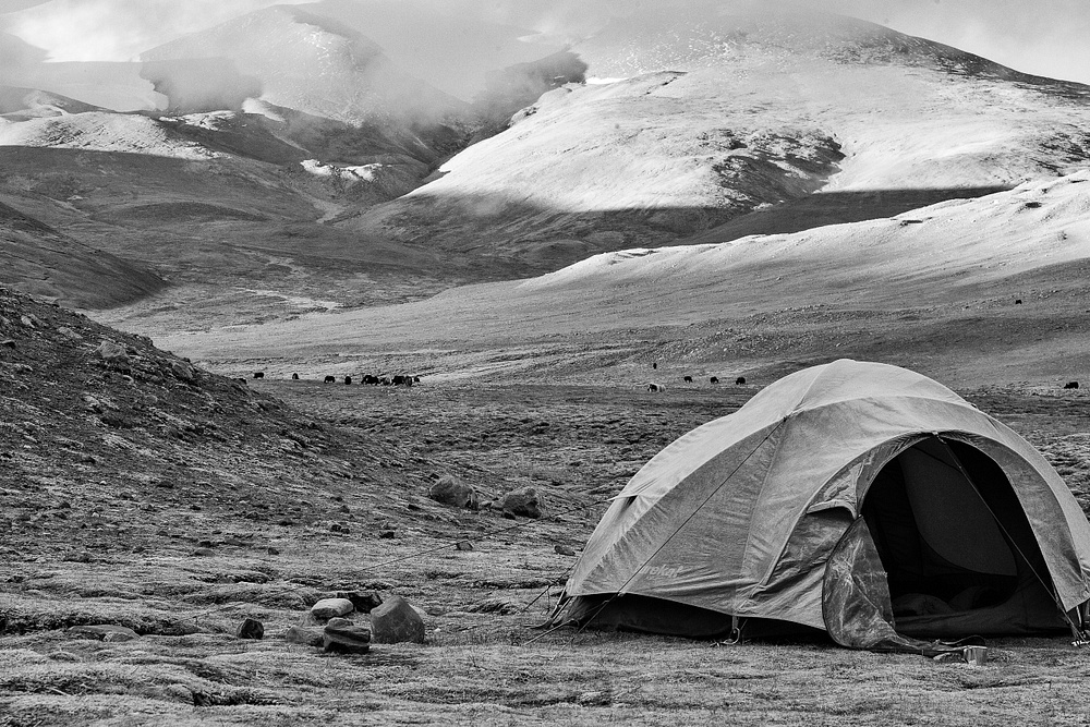
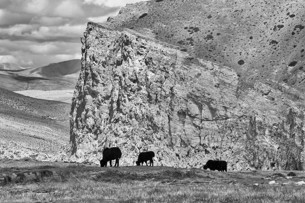
The following day my trek continued up and over Lamna La (elevation 16,896 feet) and into a very peaceful high valley that served as grazing pasture for yaks. In this valley, I shared a campsite with a lone nomad as he had set up his temporary home until his 30 yaks would finish grazing the area. I recall waking early the next morning and stepping outside my frost-covered tent into the crisp clear air and feeling as if in another world, hearing no sound other than the wind, and seeing no movement except for the yaks slowly wandering through their pasture, and with no sign of people but the tent of the nomad. I felt so wild and so free as I walked alone through the valley but yet so small and so enclosed by the very high Himalayan peaks that surrounded me.
 Temporary Nomad home.
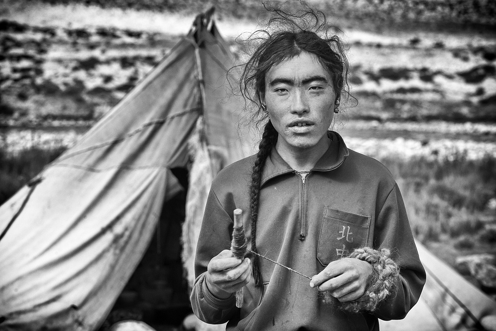 Tibetan Nomad spinning yak wool.
 Buddhist nun at Rongbuk Monastery.
 The large chorten at Rongbuk Monastery.
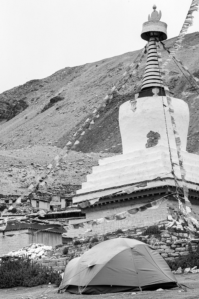
On day 3 of my trek, I arrived at the Rongbuk Monastery, which is claimed to be the highest monastery in the world at an elevation of 16,434 feet. It was founded in 1902 in this area where meditation huts and caves had been used by communities of Buddhist nuns for more than a hundred years. Today it remains a destination for special Buddhist pilgrimages. The monastery was completely destroyed during the Cultural Revolution, with partial reconstruction commencing in 1983. During my one-night stay here the nuns granted me permission to set up a tent in an open area beside the monastery. I may likely never experience another campsite in such an amazing scene, located beneath the prayer flags and the chorten of the monastery and with a view from the door of my tent that presented the full 12,000-foot vertical north face of Mount Everest.
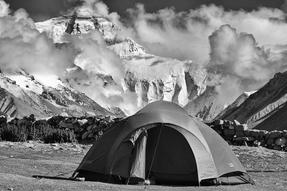 My campsite at Rongbuk Monastery with Everest as a spectacular backdrop.
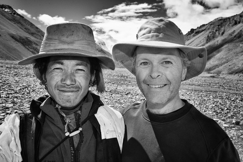
 Yak herder who provided essential support for our trek to Camp I.
From the Rongbuk Monastery, I had an easy walk the next day to the tent village of Everest Base Camp where I camped for one night. Base Camp was very quiet while I was there, with only one group attempting to summit (a father and son team from Poland who were hoping to finish the last climb of their joint goal of the Seven Summits) and a couple of groups who were trekking to Advanced Base Camp.
The following morning it was time to load up the four yaks that my guide had hired from a local yak herder. The yaks would carry all of the gear needed to continue my trek up the valley towards Everest and then to the East Rongbuk Glacier. The view of Everest’s north face loomed high over us as we approached but then gradually disappeared behind a wall of rock as we turned east and up the glacier.
 Leaving base camp towards Everest and East Rongbuk Glacier.
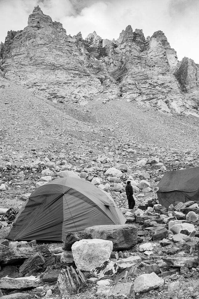 Camp I at 18.300 feet.
My campsite for the next two nights was at the traditional Camp 1 on the East Rongbuk Glacier at an elevation of 18,300 feet, allowing me a full day to do the return trek to the ice seracs just beyond 20,000 feet at Camp 2. My tent was perched amongst a field of boulders with near vertical walls of rock on each side and an icy cold river running down the glacier to join with run-off from the Central and Western Rongbuk Glaciers to ultimately continue north through the Rongbuk Valley. I recall lying in my sleeping bag that night wearing many layers including my down jacket in a desperate attempt to keep warm.
After a mostly sleepless night, it felt so good to get out of the tent, move my body, and feel some warmth as the sun eventually rose over the mountains. Soon I was on my way up the mountain accompanied only by the owner of the yaks because my guide was not feeling well and decided it was best for him to stay at the campsite. Although the yak owner and I could not communicate verbally I could feel the camaraderie as we slowly walked together toward our destination.
Trekking at this level was very difficult because of the very thin air, with oxygen levels at only 50% of that at sea level. To keep my load light I didn’t even take my camera on this last stage of the trek. I still can't believe I did that! The photo of the ice seracs shown on the next page is not mine, but is from the internet as I wanted to show the magnificent scene where my friend and I sat and shared a very international lunch of both Tsampa (a Himalayan staple food made from roasted barley flour) and Twix Bars! This brief experience surrounded by such beauty while on the world’s highest mountain was surreal, and was the perfect way to end the trek. From here it was back down to the campsite for one more night before heading back to Lhasa the next day.
 Ice seracs at 20,000 feet (Photo by Paul Quayle - Alamy Stock Photo)
 Sharing the joy after reaching our destination.
To my surprise, the journey back to Lhasa would also be amazing. Our route had us drive from Base Camp to spend one night in the village of Tashi Dzom, with the following day continuing to the high pass at Pang La, and then to the Friendship Highway for the very long drive back to Lhasa.
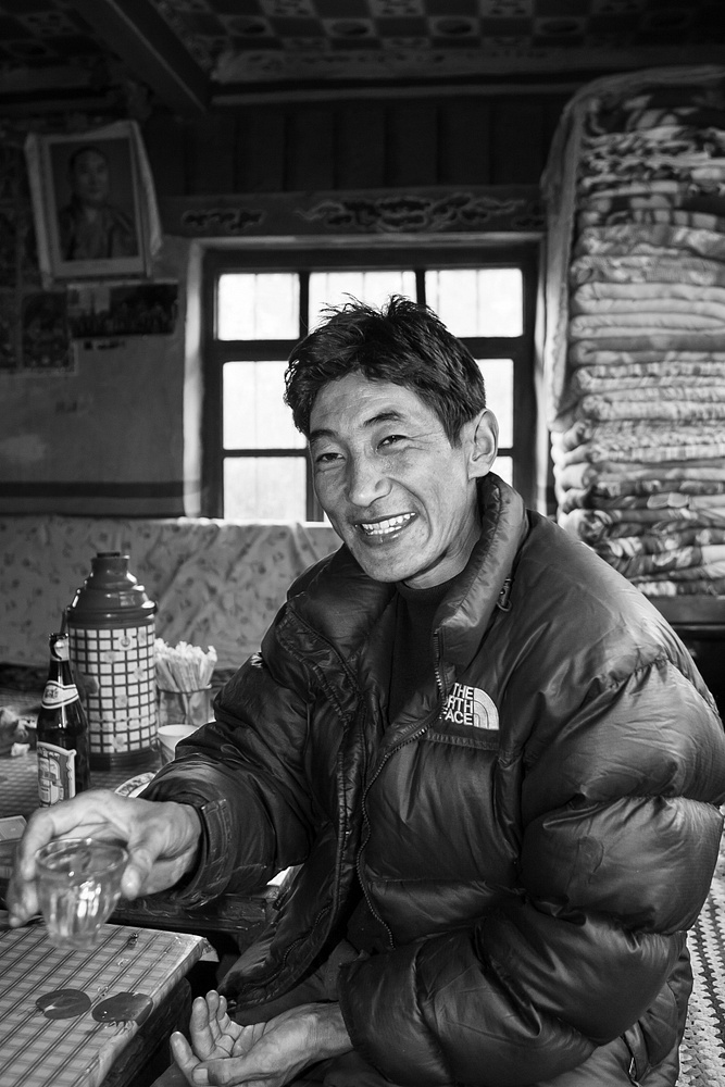
My one night in Tashi Dzom was at the Cho Mo Lang Ma Ben Ba Guest House, perhaps the dirtiest guesthouse in which I have ever stayed. But it didn’t matter, as this night turned into a celebration with my team of Tsering (guide), Purbu (cook), and Tashi (driver) as they were very happy that we had succeeded in achieving all that we had set out to do. Playing cards with them was not my smartest decision, as they knew the rules of the game and I didn’t, and they decided to speak only Tibetan and I couldn't. The loser of each hand had to drink a shot of beer. Needless to say, I didn't win many hands! But it was a fun and very happy time as we were joined in the celebration by the owners of the guesthouse and some of their guests.
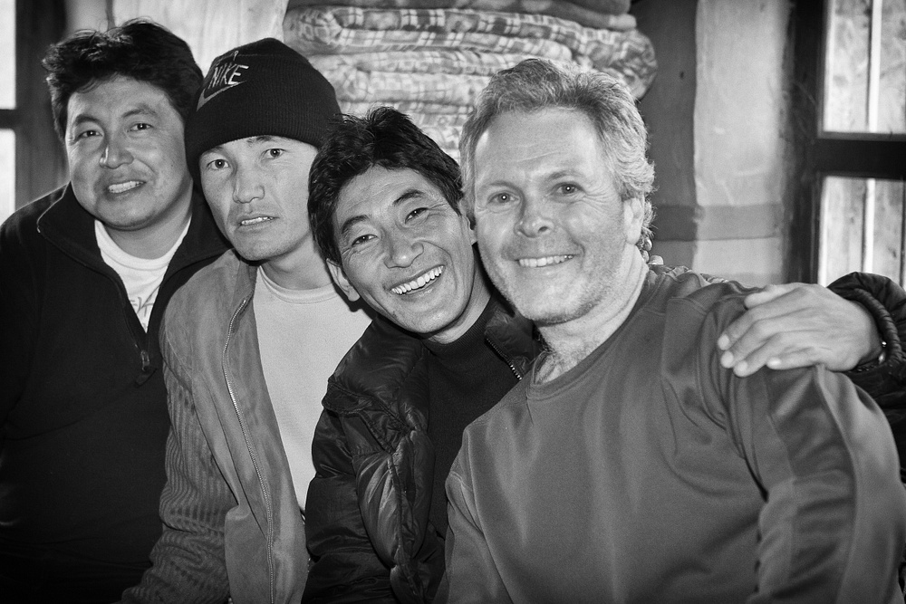 Tsering, Tashi, Purbu and me.
 Guesthouse at Teshi Ozom.
 Tsering
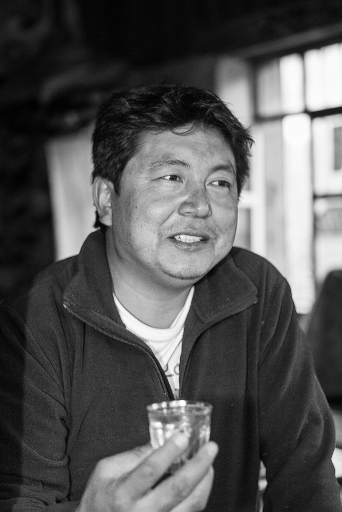
 Purbu
Purbu
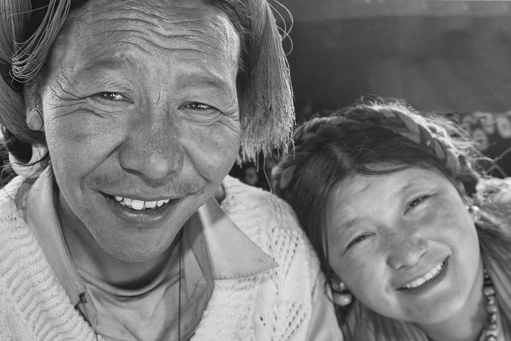 Owners of the Guesthouse.
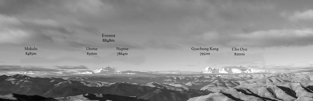 Himalayan panorama from Pang La.
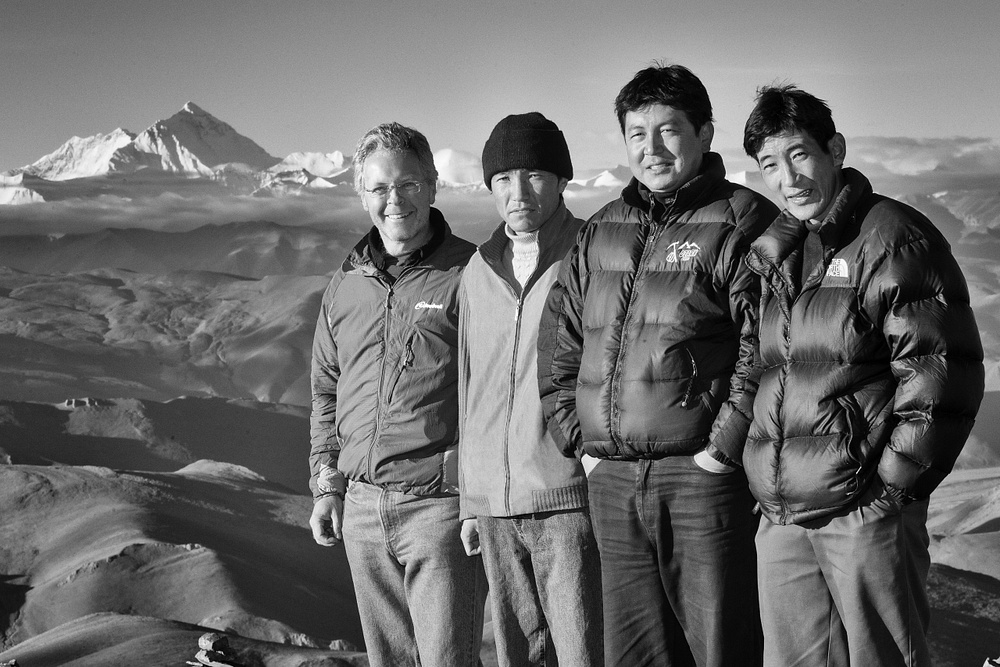
This last day of my adventure had a very special treat in store for me. Our route took us to a pass called Pang La, a spectacular viewpoint at an elevation of 17,076 feet. We arrived to clear skies that presented a view of perhaps the most amazing panorama of mountains that exists in this world. Looking south from Pang La, from left to right I could clearly see 4 of the 6 highest mountains on Earth: Makalu (27,825 feet, 5th highest mountain in world), Lhotse (27,940 feet, 4th highest mountain in world), Everest (29,032 feet, highest mountain in world), and Cho Oyu (26,864 feet, 6th highest mountain in world). And the foreground was unbelievable with many many miles of high, barren, rolling foothills. Any feeling of being unwell from our celebration the night before quickly dissipated as I was overwhelmed by the spectacle before me. As I stood there with my new friends, there was nothing to be said. We just looked at each other and smiled. I could see in their faces and in their eyes that they were very happy; not only happy at their own good fortune to be at this location at this moment, but also happy to have helped me live a very special dream. My heart was truly full as I thanked them for making this happen. For that, I am forever grateful.
 Himalayan foothills from Pang La.
 ) to see how your blog looks